When Does Autumn Start?
Autumn officially begins on September 22nd this year, astronomically speaking.
Meteorologists, on the other hand, use very general guidelines to mark the beginning (September 1st) and end (November 30th) of autumn — those dates are based on the annual temperature cycles used by weather scientists to split the year into quarters.

One of my favorite things to do when fall arrives is to begin tracking autumn leaves so that I can see when and where they’re changing colors across the U.S.
It seems like there are more ways than ever to find out the fall weather forecast, which can tell you what’s happening with the leaves.
Using Fall Foliage Maps & Trackers
When I’m planning a fall leaf trip, I like to know when and where peak colors are going to appear in each part of the country. I use a fall foliage map to help me find out what the leaf reports are all around the country.
There are some really great leaf trackers that are specific to certain regions of the U.S. — because fall colors arrive (by turning yellow, then orange, then red) and peak (showing the most vibrant hues) at very different times, depending on where you are.
For example:
- New England is one of the most popular spots for leaf peeping and one of the first places in the U.S. where the colorful fall leaves arrive before anywhere else.
- In parts of Maine and Minnesota, autumn leaves begin turning as early as mid to late August.
- If you’re living anywhere north of Atlanta Georgia, you will probably begin seeing a grander autumnal rainbow as early as mid September.
- In the West, the colors light up the Rockies and adorn the higher altitudes on either side of the mountain range from mid September through October.
- Down south closer to where I live, the first hints of fall show up on our trees in late September or early October.
Of course, when and where the fall colors will show up is largely based on the weather conditions during late summer and early autumn — the arrival of fall foliage in your area will vary somewhat from year to year.
Fortunately, there are some REALLY great up-to-date fall foliage maps for leaf peepers to peep at before they venture out to do some fall leaf peeping.
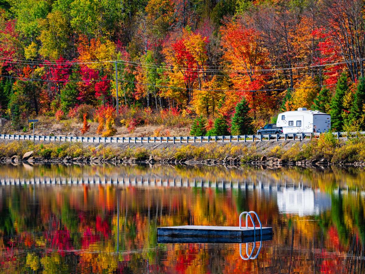
No matter where you live in the United States, fall color is never more than a scenic drive away during the months of September, October, and November!
Got it, my peeps?
See Where Peak Colors Are Now In The USA
A good fall foliage map will provide you not only the information on where the fall colors are, but also the typical times during the season when fall colors will actually arrive there. That latter part is most helpful because many vacationers need to know ahead of time when to make hotel reservations. After all, in places like Asheville, North Carolina — the southern mecca for fall foliage fun — hotel rooms are often booked solid during the month of October.
For people such as myself who want to see a bolder display of color than I can get locally, planning a fall colors tour means knowing weeks in advance where I need to be to see the colorful leaves.
These are the 5 best U.S. fall foliage tools:
#1 – To get a general idea of when the leaves will be at their peak colors across the USA, a quick glance at this Fall Colors Prediction Map by Intellicast will give you a good idea:

#2 – The Foliage Report is maintained by the NOAA Weather Ready Nation team. They dutifully track the vibrant color changes across the entire United States — with daily (even hourly!) updates.
#3 – To see this year’s predictions for when the leaves are going to be at their peak anywhere in the continental United States, use this Nationwide Peak Foliage Prediction Map. This one-of-a-kind map uses an advanced algorithm to make sense of 48,000 data points in order to display the upcoming dates when color will be the most vibrant near you — or where you’re going to travel. (TIP: Slide the date bar to the right to get a more accurate prediction of the colors for any area of the U.S. through the end of November.)
#4 – These Weather Underground maps are constantly monitoring the changing colors across the U.S. You can compare their regularly updated regional maps with the last map on the page which shows the “typical” times for peak colors across the entire United States.
#5 – Explore Fall’s live map uses advanced technology and data sources to provide daily updates to their season-long fall foliage maps for the United States. They claim that their fall foliage information is more accurate and up-to-date than any other source on the web because it’s trained entirely on observations.
Check out these Fall Foliage Hotlines to find out when the colorful leaves will appear in every state. (More here.)

But, if you want a map that is a little closer to home to check out the colorful leaves in your own area, then START HERE…
See Current Leaf Reports In Each Part Of The U.S.
It’s convenient that some of the best fall foliage trackers focus on only certain parts of the country. Usually, these regional leaf trackers have dedicated leaf peepers who want to focus on what’s happening with the leaves in their neck of the woods. For the sake of this post, I’ve divided the United States into 4 leaf peeping regions:
Each of the following leaf trackers and fall foliage guides will show you:
- Where the leaves are changing color right now
- What percentage of the foliage is showing its fall colors
- When and where other parts of the United States will see their leaves change color
Alrighty then… let’s get started!
Here are the 4 best fall foliage maps that I rely on each year to help me find where the fall colors are currently AND when they’re expected to peak…
Best Northeast & New England Fall Foliage Map
Hands down, my favorite fall leaf tracking site for the Northeast and New England region is Yankee Foliage. It’s an interactive site, and the data is largely user generated.

Yes, this leaf tracker focuses on New England. However, I like that this site also includes info on where the fall color is throughout other parts of the United States, too.
The map shows where there are still green leaves, where leaves are just starting to turn, the best spots to find peak color, and where the fall leaf color is already fading.
If you check in every couple days, you can “watch” the fall color reports trickle south toward Pennsylvania and New York and east over to the Atlantic.
Best Central & Midwest Fall Foliage Map
It seems most of the fall foliage trackers are focused on the eastern half of the United States, but the Foliage Network has a section dedicated to the Midwest and Central regions of the United States.

Reporting on the Foliage Network begins in September and lasts through autumn. So if you’re checking this site out in, say, June or July to start planning a trip for later in the year, you may not find what you’re looking for. But once the site does come alive early in September, you can expect to see updates from spotters about twice a week.
Since this site uses actual, on-the-ground data instead of annual averages or predictions, you can be very sure that the data reflects what’s really happening right now.
As a fall leaf tracker, this is one site I go to again and again each autumn to monitor the arrival of color in the Midwest and other parts of the country.
Best Southeast Fall Foliage Map
When I think of fall foliage in the Southeast United States, my mind immediately turns to driving along the Blue Ridge Parkway. The Blue Ridge Parkway Fall Color Finder is great because it speaks to all the towns along and in the vicinity of this famous highway!

Of course, it’s not surprising that the Blue Ridge Parkway keeps close tabs on the fall color. After all, the scenic roadway, which cuts through the mountainous regions of North Carolina and Virginia, is perhaps the single-most popular route in the entire United States for leaf peepers. It regularly draws not only people from the Southeast, but from other parts of the United States as well.
I also want to give an honorable mention to the Asheville, North Carolina Fall Foliage Map — because Asheville provides some stunning views of autumn color, and it’s in close proximity to the Blue Ridge Parkway and the Great Smoky Mountains!
Best Western & Pacific Fall Foliage Map

It seems the West is, unfortunately, one of the more underrated regions when it comes to fall foliage.
While there aren’t many comprehensive fall leaf trackers geared toward the West, there are several great websites that highlight individual areas for seeing fall color in California, the Rockies, and the Pacific Northwest.
Here are a few of my favorites:
MUST SEE: Fall Foliage Live Webcams! (more here)
Before You Plan A Fall Leaf Vacation…
Like many of us (and certainly myself included), we like to plan a fall leaf vacation weeks or months in advance.
That’s great, and it’s frankly the best way to guarantee getting a hotel room in the area you want to stay — especially if you’re planning your autumn vacation in a popular fall tourist spot like New Hampshire, Vermont, or North Carolina.
But…
Always remember when using any fall color prediction map that Mother Nature could throw a curve ball:
- Unforeseen wet weather may mute the fall colors.
- A last-minute ice storm might cut the color short.
- Gusty winds may knock leaves off of the trees before they’ve had a full chance to change color.
- A last-minute weather event may completely interrupt the leaf changing process.
In other words, plan your fall foliage vacation ahead of time — and be prepared to drive a little farther than you first planned. You might need to spend a little extra time seeking fall colors if the specific spot you planned on touring isn’t quite what you had expected!
Did You Know?… The best fall foliage occurs after a moist growing season followed by a late summer and early autumn with warm days and cool, dry nights.
This video explains what it means if fall colors seem to be sticking around longer than usual:
More Tips For Viewing Colorful Autumn Leaves
- The Science Behind Leaves Changing Colors
- Dates For Every State’s Anticipated Peak Colors
- 22 Best Places To See Fall Colors In The U.S.
- Where To Take A Scenic Road Trip For Fall Colors In The USA
- What It’s Like Seeing New England Fall Colors By Train
- U.S. Map Showing Projected Color Changes Sept 1 To Dec 31